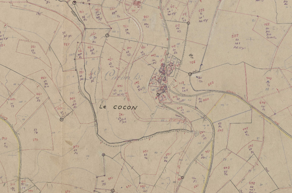
Map of Le Cocon Circa 1938
What is clear is that on the 19th of December 1943, M.Sonnery was arrested, and the temporary refuge of the Maquis at Le Cocon was destroyed.
According to Roger Chavanet and Marcel Chadebech – The Maquis arrived at Le Cocon around the 14th of December 1943. Chadebech explains,
“In the morning, 14/12/43, after this exhausting race, all soaked and shivering, we arrive at the Cocon. It is an old farmhouse, where we find a few loads of hay on which everyone collapses and falls asleep despite the humidity and cold.”
However, the location was too close to the town.
“… it would have been dangerous to park at the “Cocon”. The decision was made to move again. And on the night of the 17th of December to 18th, under an icy rain, guided by one of our farmer friends who knew the region thoroughly, the men of the “Desthieux” camp travelled the five kilometres that separated them from a farmhouse located in the woods towards St-Cyr-le-Chatou, at the place called the “Parasoir”. It was time because on the 19th of December at dawn, three columns of Germans converged on the “Cocon”. “
They had spent just a few days at this location.
So where was this refuge located?
There are stories of Le Cocon being burnt down by the Maquis, the malice or the Germans, or being subjected to an onslaught of mortar fire by the Germans. Whatever happened, Le Cocon did not survive and is now very difficult to find. Consequently, the exact location is often misinterpreted.
- We know that before 1943 there must have existed, in the hamlet of Le Cocon, a small building that would rarely have been visited.
- They would have arrived from their previous location at la Forêt de Brou, crossing La Vallée d’Azergues near Le Néanne and rising to the hills above Chamelet.
- By 1944, the building would have been severely damaged, even destroyed.
- Inevitably the stones from the building would have been used on other projects in the intervening years.
- Unless the building had been directly accessible from the road or a track, it would be almost inviable after 80 years of foliage growth.
There is only one such location that matches this description.
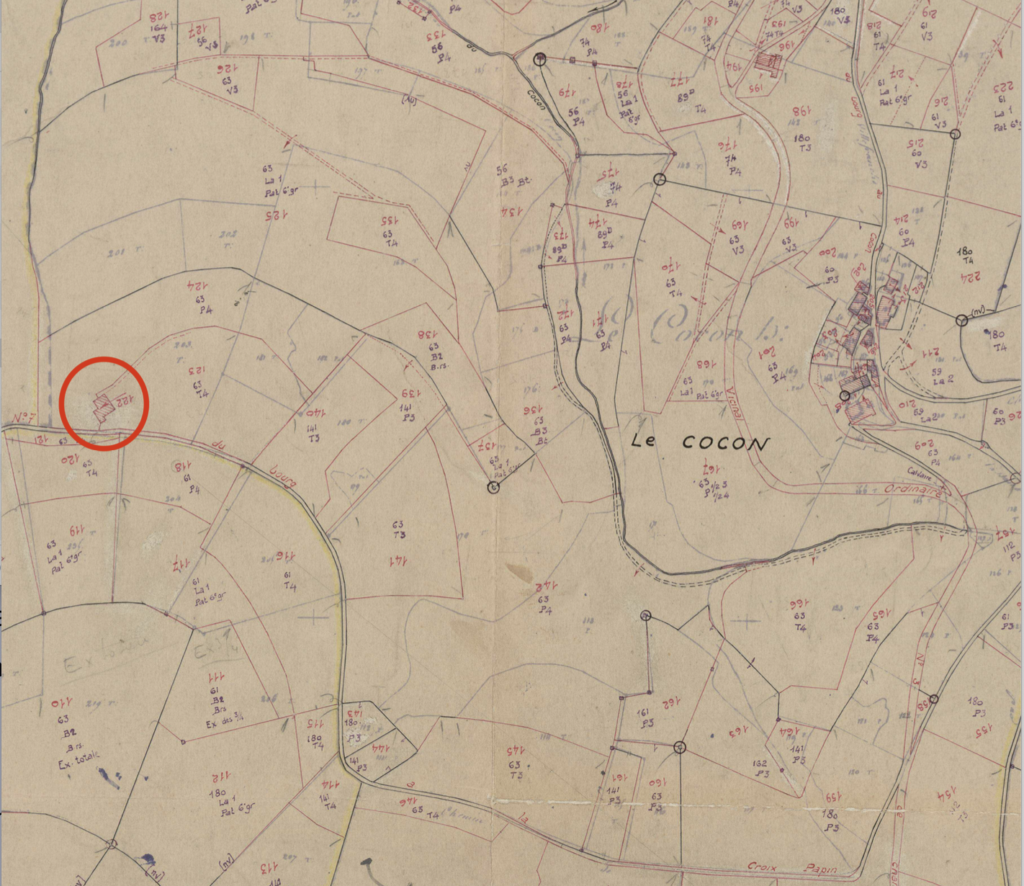
Plan of La Cocon Highlighting the small farm on the zone owned by Cazaban révisé pour 1938.
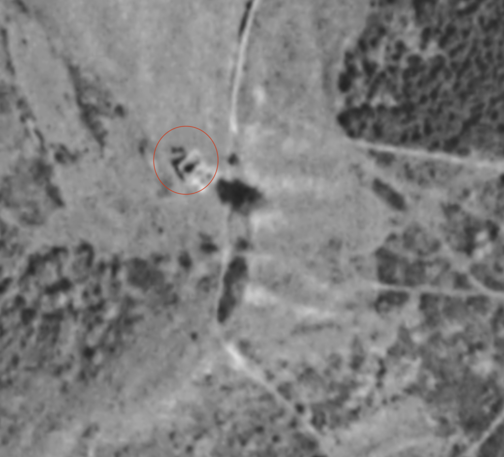
Aerial Photo Highlighting the small farm on the land owned by M. CASABAN at La Cocon Photo 1965.
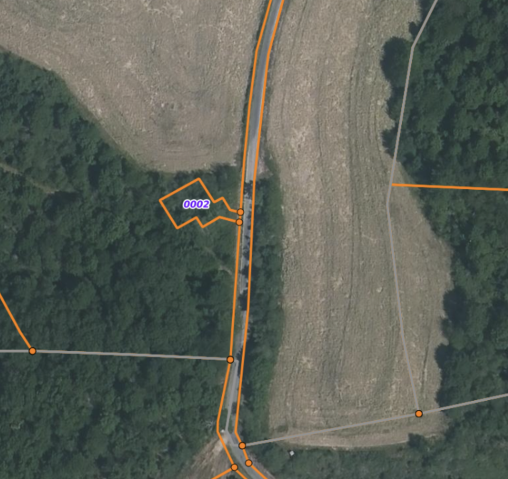
Satellite Photo Highlighting Parcel Cadastral